Guttrum and Benwell Forests

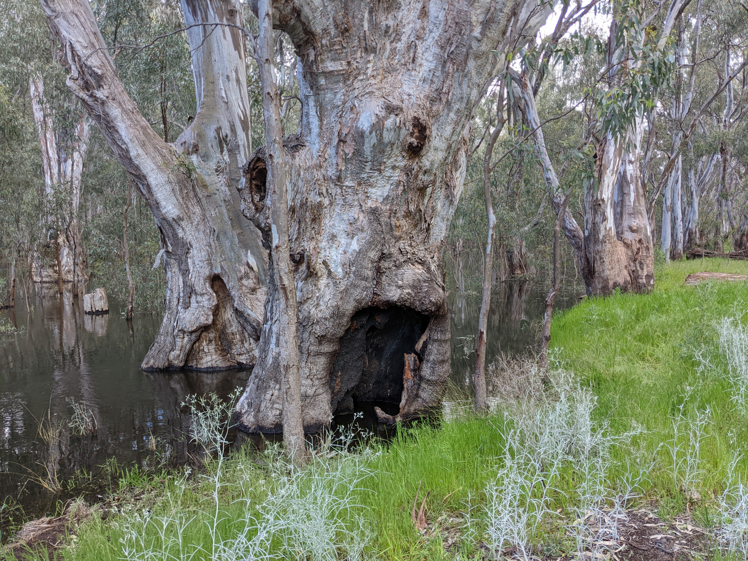
Guttrum and Benwell forests are significant river red gum floodplain forests along the Murray River, supporting wetlands, wildlife and cultural values.

Latest news

The Environment Report and draft Planning Scheme Amendment were on public exhibition from 30 March to 12 May 2026, followed by a public hearing. The Standing Inquiry and Advisory Committee is now considering all submissions, presentations and evidence to inform its report and recommendations to the Minister for Planning. To find out more about this process, visit the Engage Victoria website.  

About

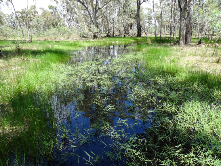
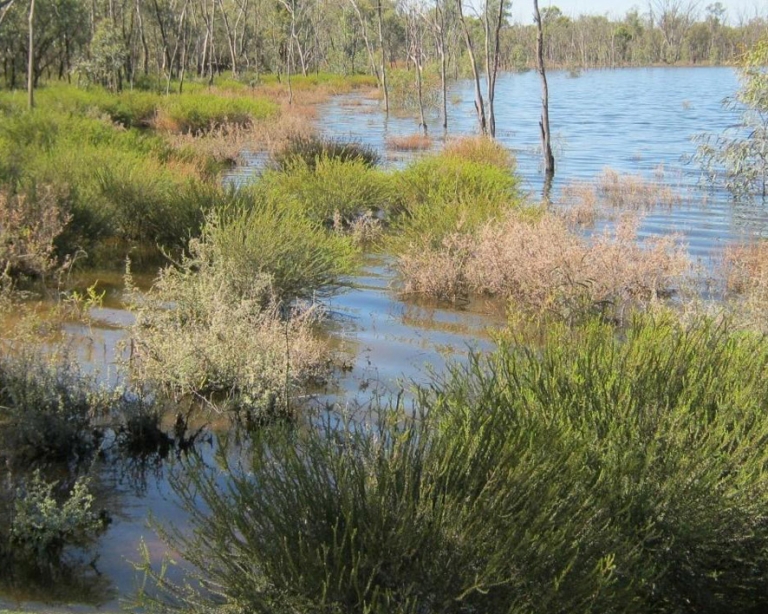
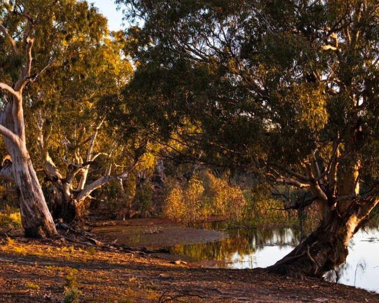
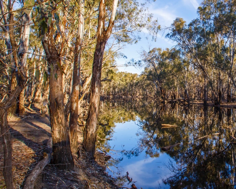
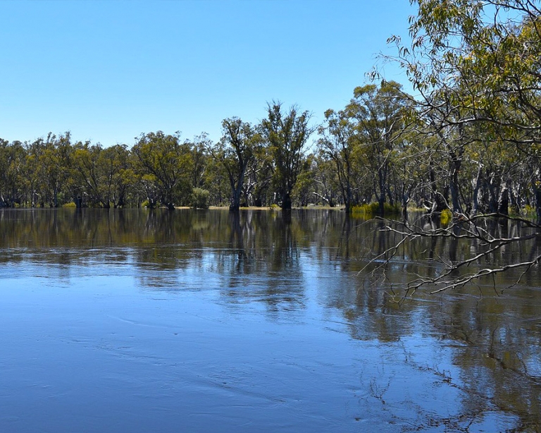
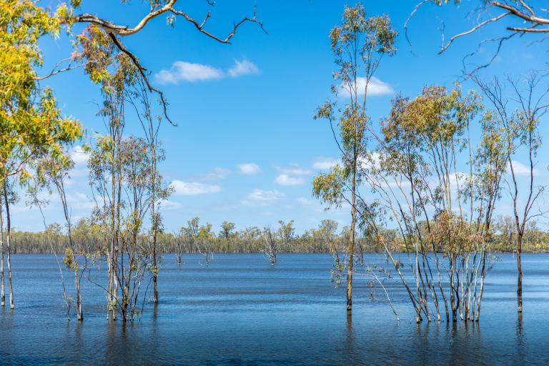
Guttrum and Benwell forests are floodplain forests along the Murray River that are recognised as environmentally significant sites important to the biodiversity of the lower Murray region, and support a wide range of recreational and cultural values important to the local community. Together, the forests cover almost 2,000 hectares of Murray River floodplain and form part of the mid-Murray floodplain. 

The Murray River and its floodplains evolved to flood regularly, supporting water-dependant river red-gum forests, wetlands and a wide range of native plants and animals. Over time, river regulation, such as dams, weirs, levees and irrigation infrastructure, has reduced the frequency, duration and extent of flooding across the floodplain. 

At Guttrum and Benwell forests, some wetlands and forest areas now experience flows far less often than they need to stay healthy. In other areas, water has been delivered too frequently or at the wrong time of year, leading to stressed trees, changes in understorey vegetation and reduced habitat quality for wildlife. 

VMFRP environmental works will help these floodplains to ecologically function more like they once did, restoring flow patterns that are more aligned to the hydraulic needs of the floodplain and protecting them for future generations to enjoy. Water for the environment will help improve the health, structure and regeneration of canopy species, and increase the diversity and abundance of flood-dependent understorey species such as grasses and shrubs, ; and restore habitat for wildlife that depends on flows to survive such as waterbirds and frogs as wetland health and conditions improve.  

Guttrum and Benwell forests are places of deep cultural, spiritual and historical significance for First Nations people, including the Barapa Barapa and Wamba Wemba people. Protecting cult;ural heritage and working closely with First Nations people is a key consideration in planning and delivering the project.  

The project will help ensure the Guttrum and Benwell floodplains remain healthy, resilient, and protected for future generations. 

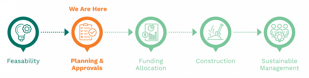
Project milestones:
Project features

The project proposes new and upgraded floodplain infrastructure that will work with high river flows and water for the environment to improve watering regimes across parts of Guttrum and Benwell forests.  

Proposed infrastructure includes: 

  • pump stations to deliver water to the right place at the right time when river levels are too low to cause floodplain inundation 
  • gated structures (regulators) and containment works to manage water movement and retain water on the floodplain 
  • structures to distribute water to wetlands and forest areas such as pipelines 
  • targeted upgrades to existing tracks where access is required for operations and monitoring.  

Infrastructure has been designed to complement high river flows, not replace them. During high river flows and floods, structures can be operated to not be an impediment to floods or allow water to move through the forest and, where appropriate, hold flows on the floodplain for longer to maximise ecological benefits using less water. 

Most containment banks will be constructed along existing tracks, with low profiles designed to blend into the landscape.  

Refer to the Guttrum and Benwell Infrastructure Map for a site map depicting the location of infrastructure. 

Location

The project site for Guttrum and Benwell forests is located in northern Victoria, near Koondrook and Barham, adjacent to the New South Wales border.  

Project benefits

  • 1,183 hectares

    Of water dependant floodplain, targeted for improved ecological health, will receive flows to meet hydraulic needs 

  • Improved tree health

    Providing hollows that birds, bats and reptiles depend on for nesting and shelter

  • 72 rare or threatened species

    Are predicted to benefit from improved habitat conditions.

  • Economic benefits

    Supporting eco-tourism and regional businesses 

  • Cultural significance

    Aboriginal cultural heritage is respected and protected.

  • Healthy landscapes

    Supporting long-term sustainability and community wellbeing

Environmental planning and assessment

Under the Environment Effects Act 1978 (Vic), the Victorian Minister for Planning determined that an Environment Report is required for the Gunbower National Park Floodplain Restoration Project and the Guttrum and Benwell Forests Floodplain Restoration Project. The Environment Report describes the potential environmental effects of the projects and identifies measures to avoid, minimise and manage impacts. An Environment Report has been prepared in response to the scoping requirements issued by the Victorian Minister for Planning. 

As part of the environmental planning and assessment pathway, a draft Planning Scheme Amendment (PSA) has also been prepared. The draft PSA proposes changes to the Gannawarra Planning Scheme to support the delivery of the projects. 

The Environment Report and draft PSA were on public exhibition from 30 March to 12 May 2026, followed by a Public Hearing. The Standing Inquiry and Advisory Committee is now considering all submissions, presentations and evidence to inform its report and recommendations to the Minister for Planning.  

The Minister for Planning will then make their assessment of the environmental effects of the project after considering the Committee’s report as well as the Environment Report, draft PSA, submissions, and any other relevant matters. 

More information on the Environment Report and assessment pathway can be found on the Engage Victoria website 

To view the Environment Report and related documents, visit the VMFRP Environmental Assessment Portal 

Proposed construction

Building infrastructure in a state forest requires careful management. If the Guttrum and Benwell forests project is approved, construction is expected to take about 12 to 18 months to complete. The construction footprinthas been idenitified and includes all infrastructure and associated construction activities, including laydown areas, site compounds, and workforce facilities, upgrades to site access and borrow sites.  The project is required to take an avoid-and-minimise approach to construction. This means that if approved, further design refinements, in consultation with stakeholders and the community, could be made, and as a result, the disturbance footprint may be reduced even further. 

Before the start of any construction, detailed designs would be finalised and additional approvals and construction permits would be required.  The community would be updated during the pre-construction period, and notified before the start of any works. 

Construction would be guided by approved environmental and cultural heritage management plans, with controls in place to protect vegetation, wildlife, water quality and culturally significant areas.  

Construction impacts would be monitored before, during and after works. Temporary construction disturbance areas would be rehabilitated, with tracks and surrounding areas restored to the same or better condition than prior to works, supporting improved long-term environmental and land management outcomes. Where possible, construction will take place on existing access tracks and areas that have already been disturbed.   

Long-term ecological monitoring would continue after construction is complete to track the recovery of the floodplain and inform future watering decisions. 

Proposed operations

Water would be delivered through a combination of natural inflows and by pumping using water for the environment. Different watering approaches will be used depending on river levels, climatic outlook, and floodplain conditions. In some years, water may flow naturally onto the floodplain. In others, infrastructure will allow water to be held for longer or delivered to areas that would otherwise remain dry without overbank flows. 

This flexible approach allows the project to respond to changing conditions, including climate change, while using water efficiently. 

Frequently Asked Questions

Why are floodplain restoration works required at Guttrum and Benwell forests?
Floodplains rely on regular wet and dry cycles to remain healthy. These cycles bring nutrients, support vegetation growth, trigger breeding events and create feeding habitat for a broad range wildlife. At Guttrum and Benwell forests, river regulation from the 1920s and landscape changes have reduced high flow events, altering the timing and volumes of water movement across the floodplain. Some wetlands now receive water infrequently, while others have experienced prolonged or poorly timed inundation, leading to declining vegetation condition and habitat loss. By restoring more natural and appropriate flow patterns, the project will help the forest recover, improve resilience to drought and climate change, and continue to support cultural, environmental and recreational values into the future.
What happens if the floodplains are not restored?
The Murray River and its floodplains are part of an interconnected ecosystem that depend on wetting and drying cycles to stay healthy and keep the river rich with nutrients. Reduced flooding has increased stress on floodplain vegetation, weakened tree canopies and reduced habitat and food for wildlife. Without intervention, these important Australian landscapes will continue to decline, placing biodiversity, cultural values and regional communities at risk. If we do not intervene, these landscapes may decline beyond the point of rejuvenation.
Why were the Guttrum and Benwell forests chosen?
The Guttrum and Benwell forests are located on the northern Victorian Murray River floodplain and are two of the last remaining intact River Red-gum floodplain systems, that are of ecological importance within the Murray-Darling Basin. Guttrum and Benwell forests support a wide range of water-dependent ecosystems, home to threatened flora and fauna species that depend on healthy wetlands, waterways, floodplains and regular inundation events to survive. The forests also offer important recreational activities and cultural sites, important to the local community and Traditional Owners, that require a healthy and functioning floodplain to continue to be available. VMFRP environmental works will support the ongoing health and resilience of the floodplain by better aligning the frequency, duration and timing of managed inundation events with the ecological and cultural needs of the floodplain.
How does the Guttrum and Benwell forests project fit within the broader VMFRP program?
The Guttrum and Benwell forests project is one part of a package of works being delivered in Victoria under the Murray-Darling Basin Plan. Floodplain infrastructure is designed to address specific ecological outcomes at each site. The decision to water a site is informed by floodplain conditions and is part of a holistic approach to keeping the Murray River and its floodplains healthy. Planning and delivery of environmental water operations is coordinated via catchment management authorities, in consultation with stakeholders including Traditional Owners, land managers, water authorities and the local community, and informed by the results of ecological monitoring programs.
Will more water have to be bought for this forest watering?
No. There is no dependency on further water recovery to make these projects operational. The projects will use existing environmental water entitlements. The Guttrum and Benwell forest projects contribute to Victoria meeting its commitments to the Murray Darling Basin Plan objectives and avoid further water buybacks from consumptive users. In Victoria, water percentage allocations are the same for both irrigation and water for the environment.
Will VMFRP water the whole forest every year? What is the timing and duration?
No. The water dependant Guttrum and Benwell floodplains require flows from the river about 3 years in 10 and about 7 years in 10 to the semi-permanent wetlands to be healthy. So depending on seasonal conditions and water for the environment allocations, VMFRP will deliver water to the floodplain to fill in the gaps between floods and high events off the river. The response of plants and animals to the flows will be closely monitored. Watering requirements are reviewed annually through the development of the Victorian Seasonal Watering Plan process and are guided by the scientific results from monitoring and weather forecasts. Find out more about the Seasonal Watering Plan and how it is developed. Because the Guttrum and Benwell forests have their own infrastructure and don’t use or interfere with irrigation infrastructure, the timing of managed watering events can be when the floodplain ecosystem needs water, usually in spring or autumn. The pumps are fully controlled, so can be started and stopped when water needs to be deployed or halted for whatever reason.
Will more flooding move native animals onto nearby farmland?
The Department of Energy, Environment and Climate Action manages many state forests and engages with adjacent landowners regularly to understand that native animals occupying farmland is an existing problem, regardless of the implementation of the VMFRP project or not. Floodwater can cause animals to seek higher ground but are more likely being attracted to the surrounding irrigated paddocks and growing pastures due to the lack of food in the dry and deteriorating forest. The proposed environmental watering events will not inundate the full forests. Guttrum forest is about 1270 hectares and the project proposes to water up to 770ha (61%) at maximum extents. Benwell forest is about 660 hectares and the project propose to water up to 450ha (68%) at maximum extents. Some flows will only reach the semi-permanent wetlands/swamps. There will be significant areas of higher ground in the forests animals can use as a refuge, and the water itself will be shallow across the forest areas. The flows will also result in improvements in food and habitat, making the forests a more attractive place for native animals. This will be something to monitor over time, and community can help with this.
How is fire being managed in the forest? How will it be managed with more watering?
The Victorian Government Department of Energy, Environment and Climate Action (DEECA) aims to deliver a reduced impact of major bushfires and other emergencies on people, property and the environment. The risk to life and property is managed in a strategic manner across the landscape. The risk of bushfire within Guttrum and Benwell forests is considered low. DEECA fire history data indicates low occurrence of fire in these forests, with small fires and no impact to life or property. The primary cause of ignition within the Guttrum and Benwell forests is from campfires. Campfire compliance (including use of electronic roadside message signs and flying of “Total Fire Ban Today” banner) is important. Fuel management programs including targeted slashing and spraying will continue to occur by DEECA. A well-maintained road network is the primary tool used to facilitate aggressive initial attack to any outbreak of fire, as well as performing as an effective fuel break. State forests will be closed on days of Code Red Fire Danger. River red-gum flood-dependant understory actually dies back and recedes back underground to become dormant when it isn’t flooded. By returning the water regime back to more like a natural condition, flooding will drown out the encroaching saplings and pest plants to also reduce the build-up of debris. DEECA will continue to manage pest plants and animals, and where the community identifies a risk, they are advised to inform DEECA who can then manage any bushfire risks.
How will European carp be managed in the forests?
The spread of carp either onto the floodplain, or from the floodplain to the river, is not considered a significant risk as the pumping of environmental water restricts carp movement (i.e. fine mesh pump screens will be installed). Additionally, the seasonal nature of watering means wetlands will regularly dry out and carp won’t have the opportunity to build up on the floodplain. But like everything, this is something to be monitored over time and to be continually vigilant about.
What about blackwater events in the forests?
Darker water that is full of nutrients and carbon is often confused as ‘black water’ but in fact it provides much-needed benefits to the river, fish and macroinvertebrates such as food. As a relevant example, there has not been one toxic blackwater event caused by water for the environment on the nearby Gunbower Forest floodplain. In fact, water for the environment reduces the risk of toxic blackwater by regularly removing the leaf litter and bark, instead of having it build up over time and get flushed into the river during a large natural flood as one hefty load of excessive organic material – which tends to be when the large and devastating hypoxic blackwater events occur. Potential for poor water quality return flows will be managed through monitoring of the return flows during drawdown periods, undertaking hypoxic blackwater risk assessment prior to delivery, and adaptively managing release rates to ensure that suitable dilution occurs from passing flows within the Murray River if water quality of return flows is low. Return flow volumes are expected to be small (5,000 ML in total across both sites), at a low flow rate (around 25 ML/day) and will occur at a time of year when passing flows in the Murray River are typically high (i.e. typically >5000 ML/day at Barham during the irrigation season) therefore the risk is considered low.
Will the environmental works impact access to Guttrum and Benwell forests?
During planning, there are no changes to access. During construction, some parts of the forest and some access tracks will not be accessible to protect people and animal safety. Future watering events may temporarily affect some tracks, similar to the tracks affected during large natural floods or high flow events. Any changes will be communicated in advance.
How will water be delivered to the Guttrum and Benwell forests floodplain?
Water will be delivered through a combination of natural inflows via the floodrunners connecting the river to the floodplain and wetlands, or managed temporary flows via permanent pump stations. Decisions are based on seasonal conditions, river flows and monitoring of floodplain health, with flooding planned in advance to support ecological outcomes while managing safety, access and water quality risks.
How would cultural heritage, values and aspirations be protected?
Traditional Owners have cultural, spiritual and economic connections to land, water and resources through their relationship with Country, built over tens of thousands of years. Working with Traditional Owners is central to protecting cultural values and informing how the project is planned and delivered. A Cultural Heritage Management Plan has been prepared for the Guttrum and Benwell forests in consultation with Traditional Owners. The plan assesses the potential impact on Aboriginal cultural heritage and outlines ways to protect cultural heritage during and after construction. These plans are required under the Aboriginal Heritage Act 2006 (Vic.). Traditional Owner values and aspirations for Guttrum and Benwell forests have also been documented, and they can not be achieved without more frequent and better-timed water on the floodplain
What will be the depth of floodplain watering events? And how is water for the environment contained on the floodplain?
Water pumped onto the floodplains is relatively shallow as the aim is to give the water dependant ecosystem a drink when it is needed, so 5 to 15 centimetres on the forest floor or to depth in semi-permanent wetlands. Water for the environment is not as deep as a flood. Existing forest perimeter flood levees are fit for purpose to contain environmental water inside Guttrum and Benwell forests. Regulators at the forest drainage points will be constructed to hold the water, either from high river flow events or pumped events, on the floodplain. These regulators can also be used to keep flood water off the floodplain and in the river if the floods are so big they might pose a risk to overtopping flood levees.
Will the project cause a salinity risk?
Groundwater aquifers under the forests are recharged during floods to then supply water dependant and deep-rooted native vegetation such a River red-gum trees. That is why these forests are located adjacent to the river. Managed events that supply water for the environment will also help to recharge groundwater aquifers and cause a slight increase in the groundwater level within the forest area. The groundwater levels will continue to vary up and down according to the weather seasons, evapotranspiration and flooding patterns. These natural processes will not cause a salinity risk. Where will the electrical power for the pump stations come from? Power lines will be trenched under existing access roads or containment banks from outside the forests to the pump stations. There is close access around the forests to existing electrical power connections.
What is the timeline for the project construction?
If the projects are approved and receive capital construction funding, the construction timeframe is estimated to take 12 to 18 months. If the river level is high, this could delay construction of the pump stations and regulators located on river banks.
How has the community been engaged in the development of the project?
A community and agency based stakeholder advisory group was established for the Guttrum and Benwell forest project in 2021 and continued through to 2026. Comprising adjacent farmers, local community members and relevant agency staff, the group helped provide advice for the development of projects. Additional public forums, drop-in information sessions and presentations to local community groups were also conducted to help inform and engage with the community.
Who is responsible for the project?
The VMFRP is funded by the Australian Government and delivered by the Victorian Government, Lower Murray Water, Goulburn-Murray Water, Mallee and North Central Catchment Management Authorities, the Department of Energy, Environment and Climate Action and Parks Victoria.

Contact the project team

If you have questions about Guttrum and Benwell Forests, or would like to provide feedback, please email the project team. We’ll put you in touch with the right person.