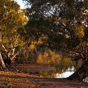
Wallpolla Island
Wallpolla Island is a large and ecologically significant Murray River floodplain, supporting nationally important wetlands, forests and wildlife.

Wallpolla Island is a large and ecologically significant Murray River floodplain, supporting nationally important wetlands, forests and wildlife.
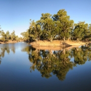
Lindsay Island is one of the largest and most ecologically significant floodplain systems within the Murray River.
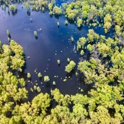
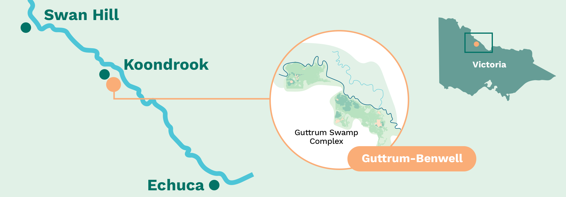
Guttrum and Benwell forests are significant river red gum floodplain forests along the Murray River, supporting wetlands, wildlife and cultural values.
Northern Victoria along the Murray River near Koondrook and Barham, adjacent to the New South Wales border.
The project area includes Guttrum State Forest and Benwell State Forest, which form part of the mid-Murray floodplain.
Guttrum and Benwell forests are priority floodplain sites being restored under the Victorian Murray Floodplain Restoration Project (VMFRP). Together, the forests cover almost 2,000 hectares of Murray River floodplain and support river red gum forests, wetlands and a wide range of native plants and animals.
The Guttrum and Benwell Forests Floodplain Restoration Project aims to restore more natural flow patterns by improving how water for the environment can be delivered to, moved across, and retained on the floodplain. Infrastructure such as pump stations, gated structures (regulators), and containment works will be used alongside high river flows to plug the gap between when water should be on the floodplain and when it is now, as well as how long it stays there.
Guttrum and Benwell forests are places of deep cultural, spiritual and historical significance for Traditional Owners, including the Barapa Barapa and Wamba Wemba people. Protecting cultural heritage and working closely with Traditional Owners is a key consideration in planning and delivering the project.
The project is currently in the planning and environmental assessment phase.
Project phase: Planning and environmental assessment
Together, the Guttrum and Benwell forests cover almost 2,000 hectares of Murray River floodplain.
Supports river red gum forests, wetlands, and flood-dependent understorey.
Uses infrastructure and environmental water to achieve ecological outcomes using less water than river flood events.
Keeps water in the region while improving floodplain health.
Supports cultural, environmental, recreational and community values.
Coming Soon.
The Murray River and its floodplains evolved to flood regularly, supporting river red gums, flood-dependent understorey, wetlands and productive food webs that sustain fish, birds and other wildlife. Over time, river regulation, including dams, weirs, levees and changes to water delivery, has reduced the frequency, duration and extent of flooding across these forests.
As a result, some wetlands now receive water too infrequently, while forest areas experience longer dry periods between floods. This has led to declining wetland vegetation, reduced understorey, stressed trees and loss of habitat for waterbirds, frogs, reptiles and native fish.
Without intervention, the condition of wetlands, forests and habitats is expected to continue declining, reducing resilience to drought and climate change.
Restoring efficient flows to Guttrum and Benwell forests will help improve the condition of wetlands and river red gum forests, increase habitat for native wildlife and return nutrient-rich water to the Murray River, supporting native fish populations.
Learn more: Guttrum and Benwell flooding frequency fact sheet (PDF)
The project proposes new and upgraded floodplain infrastructure that will work with high river flows and water for the environment to improve inundation across parts of Guttrum and Benwell forests.
Planned elements include:
Infrastructure will be designed to complement high river flows, not replace them. During floods, structures can be operated to not be an impediment to floods or allow water to move through the forest and, where appropriate, hold flood flows on the floodplain for longer to maximise ecological benefits using less water.
Where possible, infrastructure will be located on previously disturbed areas to minimise impacts on undisturbed landscapes and cultural heritage.
Why are Guttrum and Benwell Forests being restored?
Forest flows now occur less often, or at the wrong times, across parts of the floodplain, placing stress on wetlands, forests and wildlife. Restoration will help return more natural flow patterns and improve long-term ecological health.
Benwell and Guttrum State Forests support a wide range of flood-dependent ecosystems and offer important recreational activities and cultural sites, important to the local community.
What happens if we do not intervene?
Without action, vegetation condition and habitat quality are expected to continue declining, increasing risks to biodiversity, cultural heritage and the long-term resilience of the floodplain.
How often will the forests be watered?
Watering will vary depending on seasonal conditions and high river flows. Environmental water will be used to fill the gaps between high river flows, with some areas such as wetlands watered more frequently than others depending on ecological needs.
Will the project use more irrigation water?
No. The project uses existing environmental water entitlements and does not require further water buybacks. The approach helps keep more irrigation and consumptive water in the region while achieving environmental outcomes.
Will access to the forests change?
During planning, there are no changes to access. During construction or watering events, some tracks or areas may be temporarily affected. Any changes will be communicated in advance where possible.
How is cultural heritage being managed?
Cultural heritage is a key consideration. A Cultural Heritage Management Plan is being prepared in consultation with Traditional Owners to identify, protect and manage cultural values before, during and after works.
Traditional Owners have cultural, spiritual and economic connections to land, water and resources through their relationship with Country, built over tens of thousands of years. Working closely with Traditional Owners is central to protecting cultural values and informing how the project is planned and delivered.
How do Guttrum and Benwell Forests fit with other VMFRP sites?
Guttrum and Benwell Forests are floodplain sites being restored under the Victorian Murray Floodplain Restoration Project.
Together, these sites aim to improve the health of the Murray River floodplain at a landscape scale by restoring more high river flow patterns, strengthening ecological resilience and achieving environmental outcomes using water more efficiently.
Each site responds to local conditions and community context. At Guttrum and Benwell, this includes working within a State Forest setting and using infrastructure to deliver water where high flows no longer occur.
By delivering coordinated benefits across multiple floodplains, the program helps support healthier rivers, wetlands and communities along the Murray.
How will success be measured?
Monitoring programs will track vegetation condition, water quality and wildlife response over time to understand how the floodplain is responding and whether ecological objectives are being met.
Who is delivering the project?
The Victorian Murray Floodplain Restoration Project is funded by the Australian Government and delivered by the Victorian Government, Lower Murray Water, Goulburn-Murray Water, Mallee and North Central Catchment Management Authorities and Parks Victoria.
Learn more:
If you would like to receive email updates relating to the Guttrum and Benwell Forests project site, please register here:
If you have questions about the Guttrum and Benwell Forests project site, or would like to provide feedback, please email the project team: info@vmfrp.vic.gov.au and we’ll put you in touch with the right person.
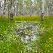
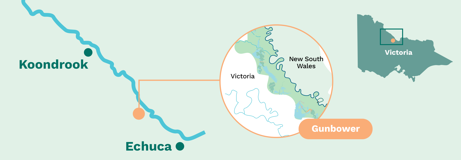
Gunbower National Park is one of Victoria’s most significant river red gum floodplain landscapes, supporting internationally important wetlands, forests and wildlife.
Northern Victoria, along the Murray River between Torrumbarry and Koondrook, near the towns of Cohuna and Gunbower. Part of the internationally significant Gunbower Forest and Murray River floodplain.
Gunbower National Park is one of the priority floodplain sites being restored under the Victorian Murray Floodplain Restoration Project (VMFRP). The site forms part of the internationally recognised Gunbower Forest, which is listed under the Ramsar Convention and in the Directory of Important Wetlands in Australia.
The Murray River and its floodplains evolved to flood regularly, supporting water dependant river red gum forests, wetlands and a wide range of native plants and animals. Over time, river regulation, such as dams, weirs, levees and irrigation infrastructure, has reduced the frequency, duration and extent of natural flooding across the floodplain.
At Gunbower National Park, some wetlands and forest areas now experience flows far less often than they need to stay healthy. In other areas, water has been delivered too frequently or at the wrong time of year, leading to stressed trees, changes in understorey vegetation and reduced habitat quality for wildlife.
The Gunbower National Park Floodplain Restoration Project aims to restore more natural flow patterns by improving how water for the environment can be delivered to, moved across, and retained on the floodplain. Carefully designed infrastructure, used alongside natural river flows and water for the environment, will allow for the gaps between what was and what should be to be plugged.
Restoring flows onto Gunbower National Park will help improve the condition of river red gum forests, wetlands and floodplain habitats. The project will support native fish, frogs, turtles, waterbirds, reptiles and mammals, and strengthen the ecological resilience of the forest to drought and climate change.
Gunbower National Park is a place of deep cultural, spiritual and historical significance for First Nations people, including the Yorta Yorta Nation Aboriginal Corporation and the Barapa Barapa. Protecting cultural heritage and working closely with First Nations people is a key consideration in planning and delivering the project.
The project is currently in the planning and environmental assessment phase.
Project phase: Planning and environmental assessment
About 550 hectares of floodplain targeted for improved ecological health across Gunbower National Park
Part of the internationally significant Gunbower Forest Ramsar site
Supports rare and threatened plants and animals, including native fish, frogs, turtles and waterbirds
Uses infrastructure and environmental water to achieve ecological outcomes using less water than river flood events
Keeps water in the region while improving floodplain health
Builds on decades of environmental management and community involvement
Coming Soon.
Floodplains rely on regular wet and dry cycles to remain healthy. These cycles bring nutrients, support vegetation growth, trigger breeding events and create feeding habitat for wildlife.
At Gunbower National Park, river regulation and landscape changes have reduced natural flows and altered water movement across the floodplain. Some wetlands now receive water too infrequently, while others have experienced prolonged or poorly timed inundation, leading to declining vegetation condition and habitat loss.
By restoring more natural and efficient flow patterns, the project will help the forest recover, improve resilience to drought and climate change, and continue to support cultural, environmental and recreational values into the future.
The project proposes new and upgraded floodplain infrastructure that will work with high river flows and environmental water to improve inundation across parts of Gunbower National Park.
Planned elements include:
Where possible, infrastructure will be located on previously disturbed areas, such as existing tracks and channels, to minimise impacts on undisturbed landscapes and cultural heritage.
Coming soon.
Why is Gunbower National Park being restored?
Forest flows now occur less often, or at the wrong times, across parts of the floodplain, placing stress on wetlands, forests and wildlife. Restoration will help return more natural flow patterns and improve long-term ecological health.
Gunbower National Park supports a wide range of flood-dependent ecosystems that provide habitat for native fish, frogs, turtles, mammals and many waterbird species. The park is also part of an internationally significant wetland system.
The area is an important cultural landscape for First Nations people. Floodplain restoration helps stabilise soils, restore vegetation and support the protection of cultural heritage values.
What happens if we do not intervene?
Without action, vegetation condition and habitat quality are expected to continue declining, increasing risks to biodiversity, cultural heritage and the long-term resilience of the floodplain.
Will the project affect access to Gunbower National Park?
During planning, there are no changes to access. During construction and future watering events, some tracks or areas may be temporarily affected. Any changes will be communicated in advance where possible.
How does Gunbower National Park fit with other VMFRP sites?
Gunbower National Park is one of the floodplain sites being restored under the Victorian Murray Floodplain Restoration Project. Together, these sites aim to improve the health of the Murray River floodplain at a landscape scale.
Each site responds to local conditions, but all share a common goal: restoring more natural flooding patterns, improving ecological resilience, and achieving environmental outcomes using water more efficiently.
By delivering coordinated benefits across multiple floodplains, the program helps support healthier rivers, wetlands and communities along the Murray River.
How is cultural heritage being managed?
A Cultural Heritage Management Plan is being prepared as part of the project’s environmental assessment process, in consultation with First Nations people. The plan assesses the potential impact on Aboriginal cultural heritage and outlines ways to protect cultural heritage before, during and after construction. These plans are required under the Aboriginal Heritage Act 2006 (Vic.) because these floodplains are areas of Aboriginal cultural heritage sensitivity.
Traditional Owners have cultural, spiritual and economic connections to land, water and resources through their relationship with Country, built over tens of thousands of years. Working closely with Traditional Owners is central to protecting cultural values and informing how the project is planned and delivered.
How will water be delivered?
Water will be delivered using a combination of:
Different approaches will be used depending on river conditions and floodplain needs. This flexible approach allows water to be used efficiently while supporting ecological outcomes.
Water delivered for the environment is relatively shallow (5 to 15 cm in depth) and will be targeted to the water dependant parts of the floodplain such as flood runners and low lying areas, not a deep flood across the whole forest floor like what happens in a flood event.
What environmental assessment and consultation has occurred?
The proposed works are being assessed through a state and Commonwealth environmental assessment process. This examines potential environmental, cultural, social and economic impacts and identifies measures to avoid or minimise effects.
Community and stakeholder engagement is an important part of planning, and feedback helps inform project design and decision-making.
Will the project use more irrigation water?
No. The project uses existing environmental water entitlements and does not require further water buybacks. The approach helps keep more irrigation and consumptive water in the region while achieving environmental outcomes.
How will success be measured?
Monitoring programs will track vegetation condition, water quality and wildlife response over time to understand how the floodplain is recovering and whether ecological objectives are being met.
Who is delivering the project?
The Victorian Murray Floodplain Restoration Project is funded by the Australian Government and delivered by the Victorian Government, Lower Murray Water, Goulburn-Murray Water, Mallee and North Central Catchment Management Authorities and Parks Victoria.
Learn more:
Download the Gunbower factsheet for further information.
If you would like to receive email updates relating to the Gunbower National Park project site, please register here:
If you have questions about the Gunbower National Park project site, or would like to provide feedback, please email the project team: info@vmfrp.vic.gov.au and we’ll put you in touch with the right person.
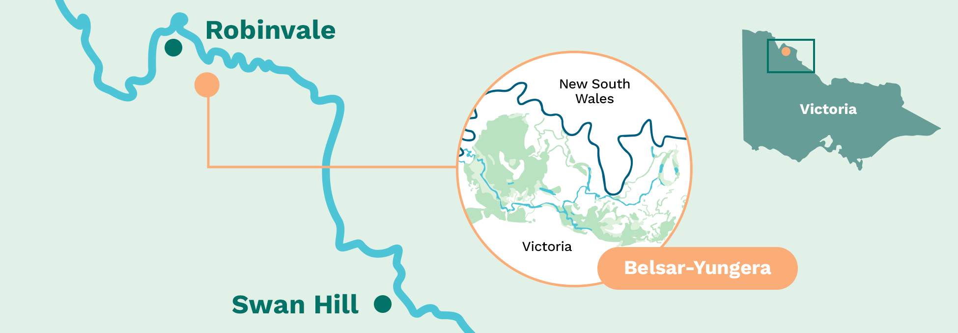
Belsar–Yungera is a large and ecologically important Murray River floodplain, supporting wetlands, forests and habitat for threatened native species.
North-west Victoria, between Mildura and Swan Hill, approximately 20–30 km south-east of Robinvale.
Part of the Murray River floodplain, including Belsar and Yungera islands and surrounding wetlands.
Belsar–Yungera is one of the priority floodplain sites being restored under the Victorian Murray Floodplain Restoration Project (VMFRP). It is a large floodplain complex made up of islands, creeks, wetlands and lakes formed by anabranches of the Murray River, including Narcooyia, Bonyaricall and Yungera creeks.
The floodplain supports river red gum forests, black box woodlands, lignum shrubland and floodplain lakes, providing habitat for a wide range of native wildlife. These include waterbirds, frogs, bats and native fish, as well as threatened species such as the growling grass frog, Murray cod, regent parrot and white-bellied sea eagle.
Historically, water from the Murray River spread regularly across the Belsar–Yungera floodplain, sustaining healthy vegetation and productive food webs. River regulation, including dams, weirs and levees, has reduced the frequency, duration and extent of natural flooding, increasing the time between flood events beyond what many flood-dependent plants and animals can tolerate.
Narcooyia Creek has also been modified over time to support irrigation delivery, further altering natural flow patterns across the floodplain. While targeted environmental watering has delivered local ecological benefits in recent years, much of the floodplain remains difficult to reach under current arrangements.
The Belsar–Yungera Floodplain Restoration Project will improve the way environmental water is delivered to, moved across and retained on the floodplain. By working with natural river flows and using targeted infrastructure, the project aims to restore more natural flooding patterns, improve connectivity between waterways and support healthier, more resilient floodplain ecosystems.
Belsar–Yungera is a place of deep cultural, spiritual and historical significance for Traditional Owners. Protecting cultural heritage and working closely with Traditional Owners is central to how the project is planned and delivered.
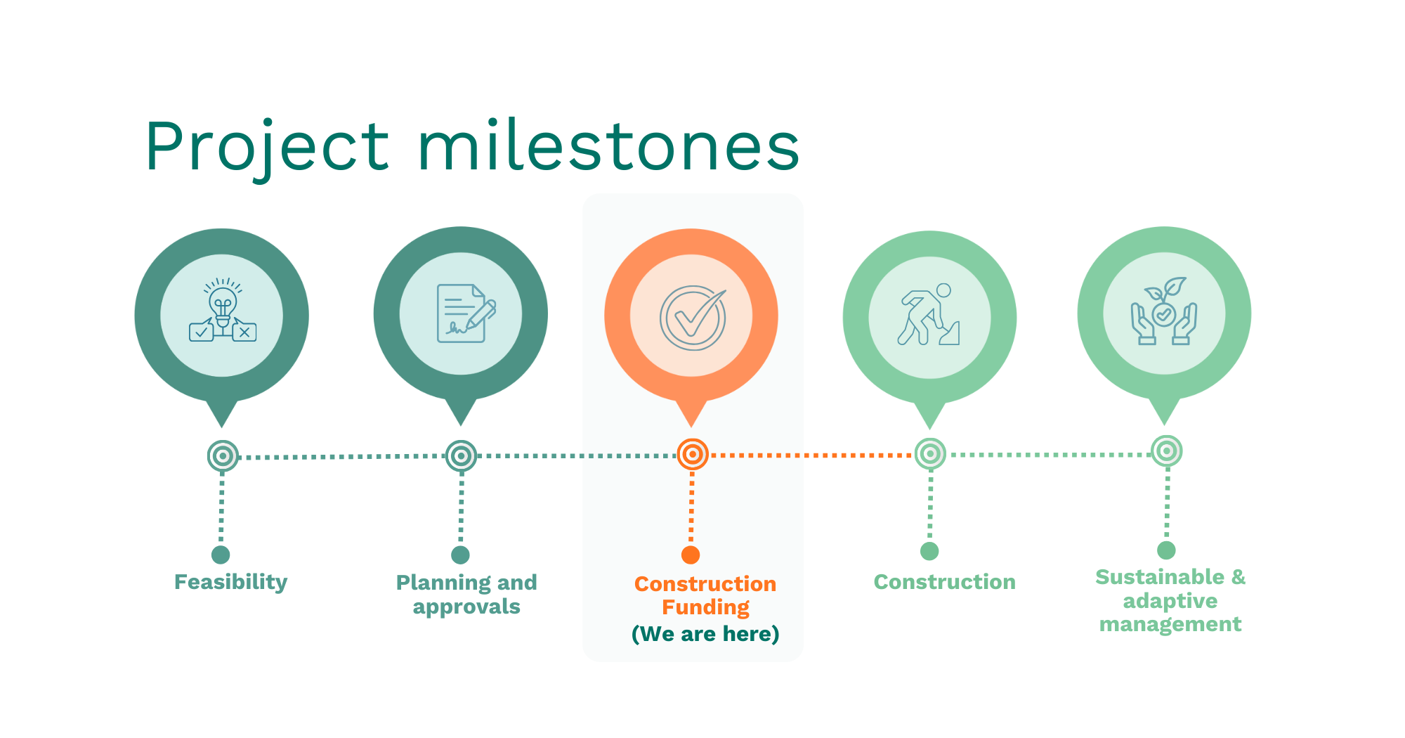
The project is currently progressing through planning and environmental assessment.
Project phase: Planning and environmental assessment
Includes Lakes Powell and Carpul, two major floodplain wetlands which is a key biodiversity corridor linking the Murray River and Mallee landscapes.
Of floodplain targeted for restoration.
Includes river red gum forest, black box woodland, lignum shrubland and floodplain lakes.
Supports threatened species including Murray cod and growling grass frog.
Uses gated structures (regulators), containment banks and temporary pumps to deliver improved environmental outcomes.
Protects cultural, environmental, recreational and community values.
Floodplains depend on regular wet and dry cycles to remain healthy. These cycles support vegetation growth, trigger breeding events for fish and frogs, create feeding habitat for waterbirds and return nutrients to the river system.
At Belsar–Yungera, river regulation has reduced flooding and increased the length of time between flood events. In some areas, dry periods now last far longer than floodplain plants and animals can tolerate, reducing the floodplain’s ability to recover from drought and increasing vulnerability to climate change.
Restoring more natural flooding patterns will help improve floodplain health, strengthen ecological resilience and support cultural, environmental and recreational values into the future.
Learn more: Belsar–Yungera flooding frequency fact sheet (PDF)
The project proposes new and upgraded floodplain infrastructure that will work alongside natural river flows and environmental water to improve inundation across the Belsar–Yungera floodplain.
Planned elements include:
The infrastructure will allow water to be delivered under different conditions:
Most infrastructure will be similar in scale to works delivered under The Living Murray program at other Murray River floodplains.
Coming soon.
Why is Belsar–Yungera being restored?
Flooding now occurs less often and for shorter periods across much of the floodplain. Restoration will help return more natural flooding patterns, improving wetland health, forest condition and habitat for native species.
Without intervention, vegetation condition and habitat quality are expected to continue declining, increasing risks to biodiversity, cultural heritage and the long-term resilience of the floodplain.
What happens if we don’t intervene?
Without intervention, wetlands, forests and waterways across the Belsar–Yungera floodplain are expected to continue declining. Extended periods without flooding place ongoing stress on flood-dependent vegetation, reduce habitat quality for native animals and weaken the floodplain’s ability to recover from drought.
Over time, declining tree health and loss of understorey vegetation can disrupt breeding cycles, reduce food and shelter for wildlife and limit movement across the floodplain. If these trends continue, parts of the floodplain may degrade beyond natural recovery, increasing risks to biodiversity, cultural heritage values and the long-term health of the Murray River system.
How often will Belsar–Yungera be watered?
Watering will vary depending on river conditions and seasonal factors. Environmental water will be used to fill the gaps between natural floods, with different parts of the floodplain watered at different frequencies based on ecological needs.
Will access to Belsar–Yungera change?
During planning, there are no changes to access. During construction or watering events, some tracks may be temporarily affected, particularly during larger floods. Any changes will be communicated in advance where possible through Parks Victoria and project updates.
How is cultural heritage being managed?
Cultural heritage is a key consideration. A Cultural Heritage Management Plan is being prepared in consultation with Traditional Owners to identify, protect and manage cultural values before, during and after works.
Traditional Owners have maintained strong cultural connections to Country for thousands of years. Working closely with Traditional Owners is central to protecting cultural values and informing how the project is planned and delivered.
How does Belsar–Yungera fit with other VMFRP sites?
Belsar–Yungera is one of the floodplain sites being restored under the VMFRP. Together, these sites aim to improve the health of the Murray River floodplain at a landscape scale by restoring connectivity and strengthening ecological resilience.
Each site responds to local conditions. At Belsar–Yungera, this includes managing water across a large floodplain with interconnected creeks, islands and wetlands that are highly sensitive to long dry periods.
How will success be measured?
Monitoring programs will track vegetation condition, water quality and wildlife response over time to understand how the floodplain is responding and whether ecological objectives are being met.
Who is delivering the project?
The Victorian Murray Floodplain Restoration Project is funded by the Australian Government and delivered by the Victorian Government, Lower Murray Water, Goulburn-Murray Water, Mallee and North Central Catchment Management Authorities and Parks Victoria.
Learn more:
If you would like to receive email updates relating to the Belsar–Yungera project site, please register here:
If you have questions about the Belsar–Yungera project site, or would like to provide feedback, please email the project team: info@vmfrp.vic.gov.au and we’ll put you in touch with the right person.