Floodplain studies and monitoring
The Murray River and its floodplains are part of a highly interconnected ecosystem. Historically, the river would spill onto the floodplains as often as 9 out of every 10 years, nourishing both the floodplain and the river, and supporting an extraordinarily rich tapestry of life.
Over time, we have changed the way the Murray flows to suit our needs, building weirs, dams and levees. We’ve benefited in many ways from regulating the river, but it has come at a serious ecological cost.
River regulation has caused blockages to flow and reduced the frequency, duration and extent of flood events. It has also caused increasingly long dry periods between floods, making it harder for floodplains to bounce back.
Varying degrees of stress are already apparent across our floodplains. The tree canopy lacks vigour and flood-tolerant vegetation are stressed, which reduces habitat and food available for animals that rely on healthy floodplains. If we do not intervene, these iconic landscapes will continue to decline, potentially beyond the point of rejuvenation.
We know from our existing environmental water programs and from infrastructure built under The Living Murray program that we can reverse this decline and restore our floodplains.
The decision to release water at a site is based on monitoring of floodplain conditions and is part of a holistic approach to keeping the Murray and its floodplains healthy.
Find out more about the studies and monitoring we are doing to continually improve our understanding and management of floodplains:
Field in Focus Technical Presentations
 Watch our Field in Focus technical presentation series to see some early insights into the work and observations of specialists assessing the potential environmental impacts (effects) of building and operating environmental works at the nine VMFRP sites.
EES portal
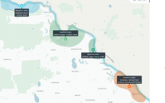 Visit our EES portal to see interactive maps, site documents, videos and environmental assessments.