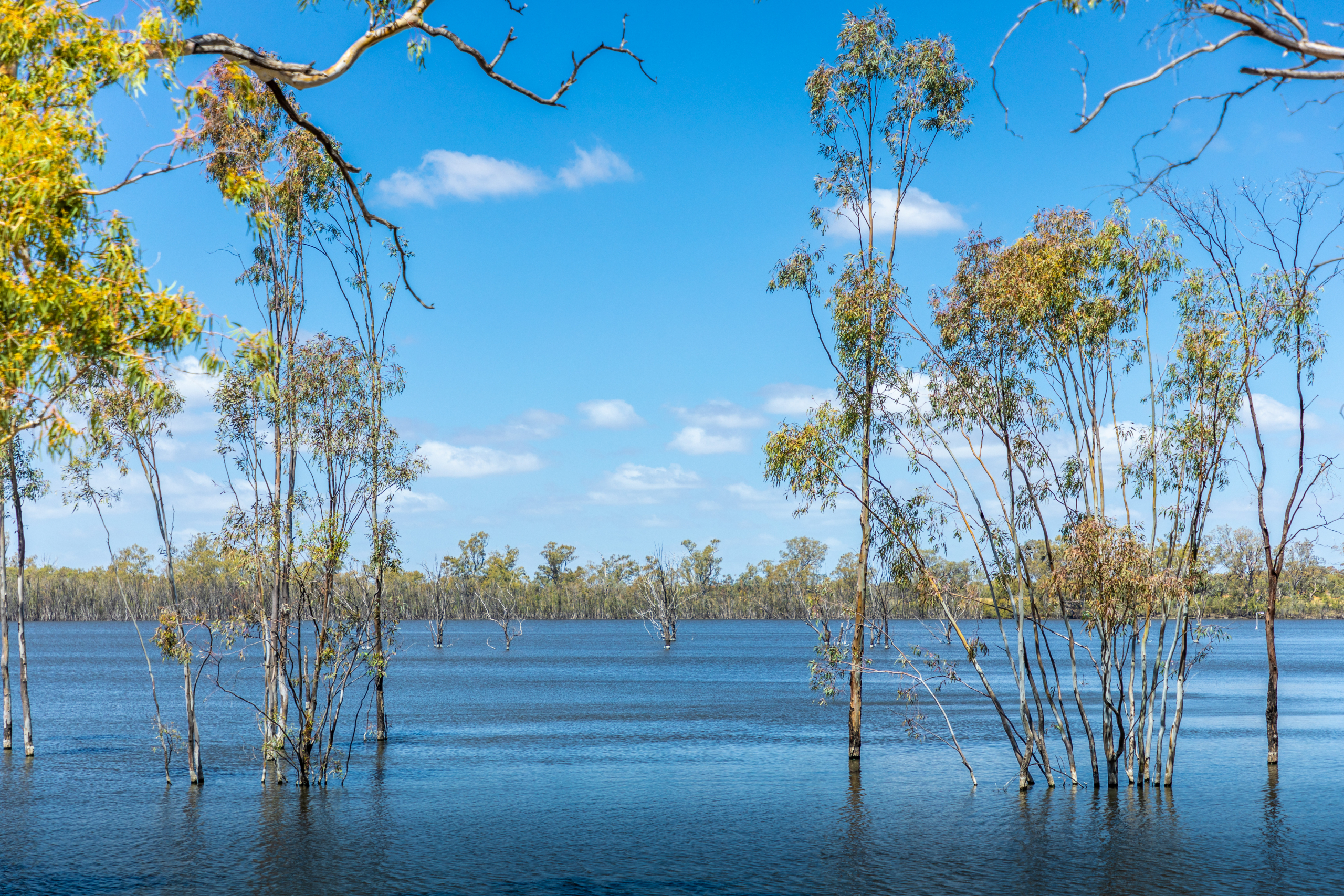
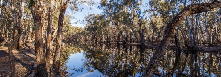
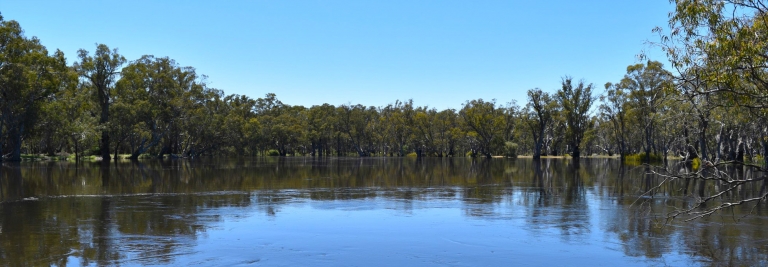
Hattah Lakes North
The Hattah Lakes are one of the Murray River’s most important floodplains.
Latest news
Construction activities have commenced. Temporary access changes and track closures within the Hattah-Kulkyne National Park are now in place. Visitors are advised to check the Parks Victoria website or the Community Update notifications below for the latest access information. To report an issue, please contact the team at 1800 808 830.
About
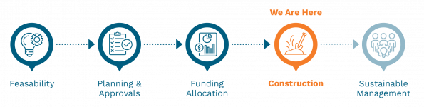
The Hattah Lakes North project is in the final stage of a long-term program to restore the internationally significant floodplains of Hattah-Kulkyne National Park.
Work has begun on the western bank of the Murray River between Robinvale and Red Cliffs, to connect the northern and southern lakes, allowing water to be delivered across the floodplain in a controlled and carefully timed way.
Previous work at the southern lakes under The Living Murray Program has improved ecological health and supported environmental and cultural outcomes. Work at the northern lakes will complete the project’s original vision.
Environmental watering will help regenerate native trees, grasses and understorey plants, stabilise sandy soils, and restore habitat for wildlife that depends on floods to survive. The park contains Ramsar-listed wetlands that provide important habitat and breeding grounds for more than 47 species of waterbirds.
Hattah-Kulkyne National Park is a special place and holds deep cultural, spiritual and historical significance for Traditional Owners. Protecting cultural heritage is a key consideration in the project’s design and delivery.
Returning water to the floodplain and stabilising soils helps prevent erosion and protect culturally sensitive sites that can be exposed as lakes dry and sands shift.
The project will help ensure Hattah’s floodplains remain healthy, resilient, and protected for future generations.
Project milestones
Project Features
Raised containment banks and gated structures known as regulators will be constructed as part of the managed water system being delivered at Hattah Lakes North.
Works near Mournpall Track
Restoration and construction work will include:
- Raised containment banks
- A five-bay gated structure (regulator) to the north
- A three-bay gated structure (regulator) at Bitterang to the south
Works near River Track
Restoration and construction work will include:
- Raised containment banks
- Two three-bay gated structures (regulators) at different locations along the track.
Refer to Hattah Infrastructure Map for a site map depicting the location of infrastructure.
Location
The project site for Hattah Lakes North is located in Victoria, 75km south of Mildura, near Robinvale.
Project benefits
-
1,237 hectares
Of lakes and floodplain targeted for improved ecological health
-
189 rare and threatened species
To benefit from improved habitat
-
Economic benefits
Supporting eco-tourism and regional businesses
-
Improved tree health
Providing hollows that birds, bats and reptiles depend on for nesting and shelter
-
Reduced erosion and improved soil stability
Preserving culturally sensitive sites that may otherwise be exposed as lakes dry and sands shift
-
Healthy landscapes
Supporting long-term sustainability and community wellbeing
Planning and compliance
The Hattah Lakes project received planning approval under the Environment Effects Act 1978 (Vic) in July 2023. The Environment Effects Statement, together with a draft Planning Scheme Amendment was on public exhibition for six weeks between October and November 2022. A public hearing was held in January and February 2023, and the Standing Inquiry and Advisory Committee referred the project to the Victorian Minister for Planning to make a final determination (to approve or reject the proposal). The Minister’s assessment concluded that while there would be some significant adverse impacts during construction, the project can achieve an overall improvement to biodiversity of the floodplain environments. As part of the conditions of approval, the construction and operation of the project must comply with the conditions set out in the Minister’s Assessment of the project.
Construction
Building infrastructure in a national park requires careful management. Construction is guided by approved environmental and cultural heritage management plans, with controls in place to protect vegetation, wildlife, water quality and culturally significant areas. Works are carefully planned and monitored in collaboration with project delivery partners to minimise impacts during construction. Where possible, construction will take place on existing access tracks and areas that have already been disturbed.
What to expect during construction
- Increased traffic and heavy vehicle movements on local roads
- Temporary changes to access within the park
- Construction activity during working hours
- Installation of temporary fencing and signage
Construction impacts will be monitored before, during and after works. If unexpected impacts occur, management approaches will be adapted in response. Long-term ecological monitoring will continue after construction is complete to track the recovery of the floodplain and inform future watering decisions.
While there will be local impacts and inconvenience during construction, the project appreciates the community’s understanding during works to protect the long-term health of the Hattah Lakes floodplain.
Temporary park access changes
Many popular camping areas and river frontage will remain open while works are taking place. Some remote river frontage will be temporarily closed, and these areas will be clearly signed.
- Mournpall Track will remain open, however temporary speed limits and traffic controls may apply
- River Track will be closed to vehicles and pedestrians at Goosefoot Track to allow works to be carried out safely
- There will be limited access via the River Track’s southern entry
Project documents
-
Download Environmental Management Framework (PDF, 2.38 MB)
Environmental Management Framework
-
Download Receiving Environment Monitoring and Reporting Program (PDF, 3.66 MB)
Receiving Environment Monitoring and Reporting Program
-
Download Ecology Monitoring and Reporting Program (PDF, 7.99 MB)
Ecology Monitoring and Reporting Program
-
Download Groundwater Monitoring and Reporting Program (PDF, 4.57 MB)
Groundwater Monitoring and Reporting Program
-
Download Construction Environmental Management Plan (PDF, 2.17 MB)
Construction Environmental Management Plan
-
Download Hattah Lakes North Infrastructure Map (PDF, 799.58 KB)
Hattah Lakes North Infrastructure Map
-
Download Hattah Lakes North Map - Temporary Access Changes (PDF, 873.57 KB)
Hattah Lakes North Map - Temporary Access Changes
Frequently Asked Questions
Why are floodplain restoration works required at Hattah Lakes?
What happens if the floodplains are not restored?
Why was Hattah Lakes North chosen?
How will the Hattah Lakes be protected during construction?
Will trees be removed as part of the project works?
How does the Hattah Lakes North project fit within the broader VMFRP program?
How will water be delivered to the Hattah Lakes North floodplain?
How do we know the project will work?
How are local Traditional Owners involved?
How is cultural heritage being managed?
Who is responsible for the project?
Recent projects
Sign up to receive updates
If you would like to receive email updates about Hattah Lakes North, please register here.
Register for updatesContact the project team
If you have questions about Hattah Lakes North, or would like to provide feedback, please email the project team. We’ll put you in touch with the right person.
info@vmfrp.vic.gov.au